AAI Scientific has a range of high-resolution Imaging, Visual, and Gas remote sensing products and services to meet your needs.
What We Offer
Services
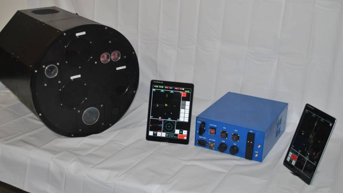
SANDS Navigation System
AAI Scientific’s remote sensing technologies are built around the SANDS (Sentinel Navigation And Data System) Navigation system. SANDS provides real-time location information to the pilot and an operator about survey segments which they are to fly over. It also provides situational awareness information to improve safety during flight.
High-Resolution Imaging and Visual
SANDS interfaces with various cameras and instrumentation to take and store geo-located imagery/data during flight. Two versions of SANDS are SANDS Visual, and SANDS Imaging
.
SANDS Visual interfaces with a hand-held camera, so that an operator can take images out the aircraft window and create live anomaly reports. These reports are then sent in real-time to the service provider, who can then send them to the customer. This allows near real-time reporting of emergencies to the customer.
SANDS Imaging interfaces with a nadir-viewing high-resolution camera mounted in a camera port on the aircraft. Images are taken automatically and continuously during the survey, and real-time in-flight report is available. Once survey is complete, the entire survey imagery can be reviewed looking for anomalies along the route.
SANDS imaging can also integrate a video camera in combination with the high-resolution camera.
Hydrocarbon Remote Sensing
SANDS Sensing interfaces with an AAI Scientific proprietary gas remote sensor known as Sentinel. The Sentinel Sensor provides geo-located maps of fugitive emissions along the pipeline right-of-ways (ROWs). SANDS Sensing also provides simultaneous SANDS Imaging imagery for threat anomalies.
Over 14 years AAI Scientific has been working with various fugitive emissions technologies for the hydrocarbon energy transmission industry. As of 2020 a third generation remote sensing detection system has been developed and built based upon previous versions and experience (Sentinel). An advantage of the AAI Scientific third generation gas-sensing systems is that it has been developed for both fix and rotor wing platforms. All other remote sensing fugitive detections systems have been built around specific aerial platforms.
AAI Scientific realizes not all pipeline energy transmission systems are the same and certain aerial platforms have safety, efficiency, and cost advantages over different systems.
Data Services
AAI Scientific provides the following data services:
SRP: Route Planner: Software package optimizes flight planning and provides safety and route information to the SANDS system.
SJP: Job Processor: Software package that geo-locates imagery and remote sensing data post-flight.
SIVER: Imaging and Visual Reporter Software reviews visual and imaging data creating anomaly reports and passes them on to clients.
TSSP: Terrain Surveillance Services Program: A secure web-based archive portal where clients review and interact with anomally current and past reports (Visual, Imaging and Sensing).
Aircraft Modifications
AAI Scientific can coordinate minor aircraft modifications and STC installations can be coordinated or handled by AAIS to a client/partner’s aircraft.
However, the SANDS Visual implementation does not require any modification to the aircraft.
Special Projects
AAI Scientific can develop and/or customize survey implementations and integrations based on the client’s needs.

Our priority: proven results delivered timely to clients
We provide world leading solutions in survey navigation and fugitive emissions and pipeline detection technologies.
Why Work With Us
Services
Safety and Flight Altitude
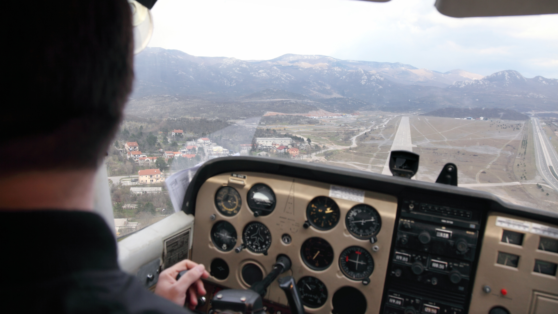
Where many other remote sensing systems are designed to operate at lower altitudes, (300’ – 500’ AGL) All AAIS systems are designed to operate at or above 1000’ AGL. This allows the aircraft to operate above ground obstacles. Additionally, AAI Scientific’s navigation system incorporates data from the FAA Digital Obstacle File (DOF) for ground-based threats as well as ADS-B for traffic in nearby airspace giving the flight crew the best situation awareness possible. Safety is a paramount concern for AAI Scientific.
Flight Path Optimization
Not all client systems (gathering, storage, transmission) are the same nor are flight characteristics of different aircraft (fixed vs rotor wing platforms). AAI Scientific has developed a software program that has been proven to optimize flight paths based upon the type of client asset system, aircraft, and many other variables (airspace, pilot experience, winds, etc.). Some clients have reported flight time savings near 10% – 12% utilizing the AAI Scientific flight path optimization software.
Navigation System Integrated with Remote Sensors
AAI Scientific’s navigation system was designed specifically for oil and gas industry aerial surveying. Most other companies rely upon off-the-shelf general aviation navigation systems. These navigation systems are not incorporated with the remote sensing hardware and act as a separate system. The AAI Scientific navigation system has a fully integrated Inertial Navigation System (INS) combined with a laser altimeter and is coupled with all remote sensing hardware. This communicates with the flight crew addressing the exact area being surveyed in relation to the production pad locations (including landfills), gathering system, transmission pipeline system, storage facilities, etc. in real time all from a single system.
Real-Time Reporting from the Aircraft
When coupled with a data downlink the AAI Scientific navigation system allows the flight crews to generate reports that can be sent in real-time for further analysis. This data includes the flight crew’s observations, GPS information, and high-resolution images. All of this information is generated from the AAI Scientific navigation system and does not require additional cameras or other equipment to clutter the cockpit area.
Post-Survey Analysis
When a survey flight has completed the data can be further scrutinized and additional detailed reports generated using the AAI Scientific post flight analysis software. All remote sensing data is synchronized with visual data (video and/or high resolution imagery) and the GPS, INS, and laser altimeter data. The AAI Scientific post flight review software then allows all flight data to be reviewed and / or generate additional reports at the end-users leisure.
Data Retention and Mining
All flight data generated, collected, and reported can then be archived using the AAI Scientific database tracking software. The AAI Scientific database software allows for queries of all aspects of the AAI Scientific systems (flight path optimization / generation, remote sensing data collected, reporting, etc.).